
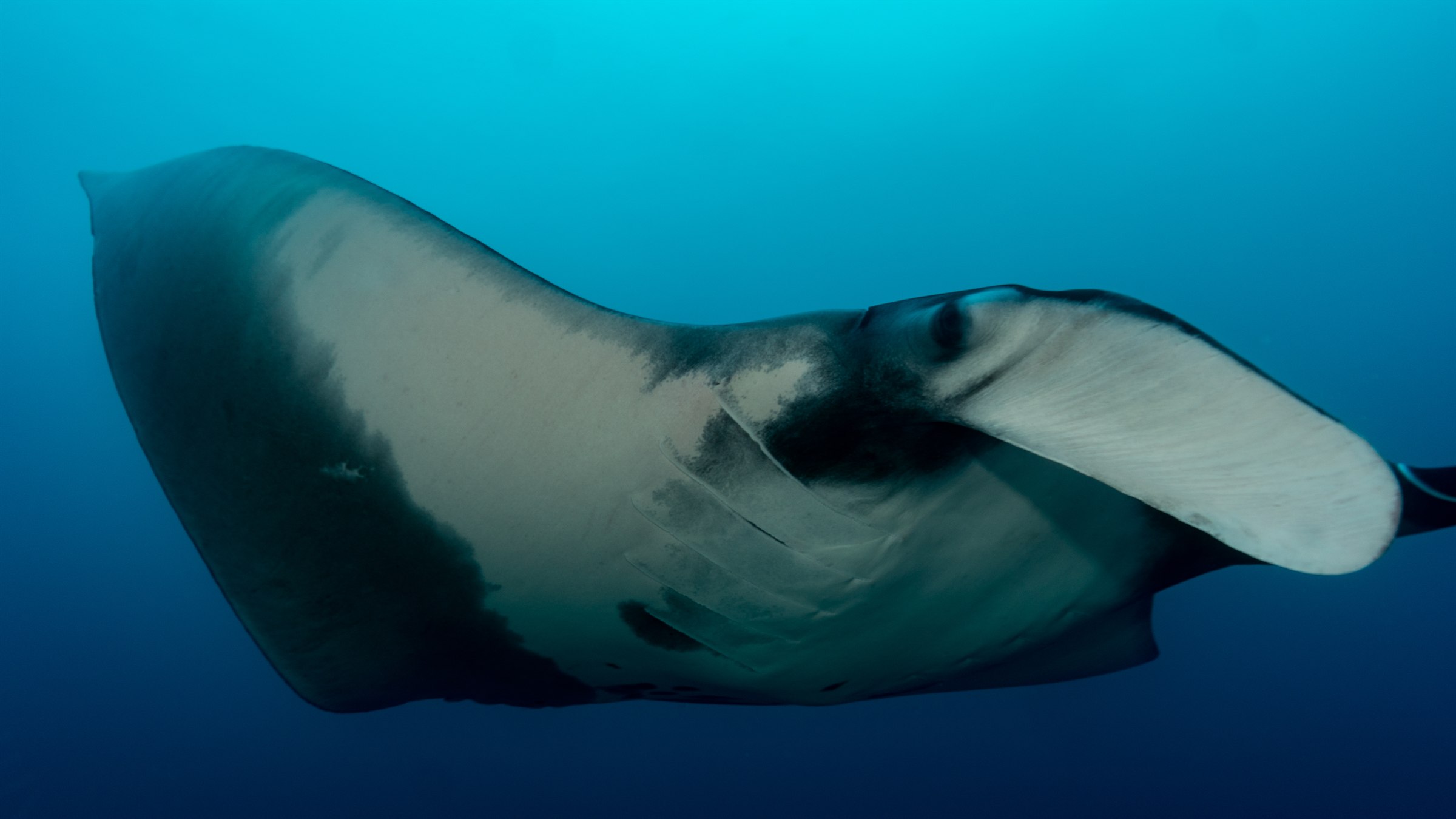
Divers who cross paths with a giant manta ray at the Catalina Islands tend to remember exactly where they were standing on the boat when it happened. The animal can span eight metres from wingtip to wingtip, and it approaches unhurried, banking and circling as if it, too, were sightseeing. What most divers don't realize is that the photo they snap on the way back up can become a data point in one of the only long-term efforts to understand this species in Costa Rican waters.
That effort has become considerably more urgent in the last few years. In 2020, the International Union for Conservation of Nature reassessed the giant oceanic manta ray for its Red List of Threatened Species and moved it from Vulnerable to Endangered: the first time a manta ray species had been given that classification. The reassessment, later amended in 2022, pointed to steep population declines over roughly two decades, driven largely by bycatch in surface drift gillnets and bottom-set nets, and by continued demand for manta gill plates in international trade.1
Part of what makes the giant manta so exposed to that pressure is basic biology. According to NOAA Fisheries, which lists the species as Threatened under the U.S. Endangered Species Act, a giant manta ray can reach a wingspan of up to 26 feet (about 8 metres) and weigh as much as 5,300 pounds, and individuals have been tracked living 45 years or more using photo-identification records. But they reproduce slowly: typically a single pup every two to three years, after a gestation of roughly a year.2 A population that loses individuals faster than it can replace them does not recover quickly, which is exactly why tracking data on where these animals actually go has become a conservation priority rather than a scientific curiosity.
Four ways to follow an animal that never stops swimming
That tracking work in Costa Rica is largely carried out by the Mantas Costa Rica project, run by the dive operator Iguana Divers together with the Centro de Rescate de Especies Marinas Amenazadas (CREMA), and recognized by the UK-based Manta Trust as one of its affiliate research projects worldwide. The project is led by Jeffry Madrigal, a marine biologist trained at Costa Rica's Universidad Nacional, who oversees the field research, data analysis and delivery of results.3
The team combines four research methods. Acoustic telemetry (tagging individual mantas with transmitters and recording their movements past underwater receivers) feeds into MigraMar, a regional research network that tracks migratory marine species across the Eastern Pacific, from Mexico to Peru, to inform protection efforts that no single country could manage alone.4 Photo identification relies on the same natural markings divers photograph out of pure enthusiasm: every manta's belly pattern of spots is as individual as a fingerprint, and images submitted by citizen-science divers are matched against Manta Trust's global photo-ID database to build a picture of population size and site fidelity. Tissue sampling adds a genetic layer, comparing DNA between Costa Rica's mantas and populations elsewhere in the Pacific. And in a milestone for the country, the Mantas Costa Rica team became the first researchers to deploy satellite tags on manta rays in Costa Rican waters, opening a way to follow individual animals across entire migratory routes rather than single dive sites.3
"The database now includes more than 120 individually identified manta rays in Costa Rica, each one a data point in a picture that, until recently, didn't exist at all." Mantas Costa Rica project, via Manta Trust
The project's research spans the entire Pacific coast of Costa Rica, with a particular concentration of fieldwork around the Reserva Natural Absoluta Cabo Blanco on the southern tip of the Nicoya Peninsula.3 The Catalina Islands, off Guanacaste further north, are a separate matter of local record rather than a formal study site named in the project's published materials, but they are one of the country's best-documented manta encounter locations, with sightings concentrated from roughly November or December through May, when oceanic upwelling draws nutrient-rich water (and the plankton that mantas filter-feed on) into the islands' currents.
What a dive log can contribute
None of this requires a research vessel. Because photo-ID is citizen-science by design, any diver's clear shot of a manta's ventral (belly) pattern is potentially useful, whether it's taken at Cabo Blanco, the Catalinas, or anywhere else along the coast, which is part of why the project also runs educational outreach through PADI courses and programs with local schools and fishing communities, building the pool of people who know what to photograph and why it matters.3
For a dive center built around private, unhurried encounters, that's a natural fit. A guest photographing a manta at the Catalinas during a Salty Horizon fun dive isn't just collecting a souvenir: with the right shot of the animal's belly pattern, submitted to Manta Trust, they're contributing to one of the only datasets tracking a newly Endangered species through Costa Rican waters.